Helping Faculty, Staff, and Students Leverage GIS
Geographic Information Systems include the hardware, software, and community involved in the collection, visualization, and analysis of spatial data. Any piece of information with a reference to location counts as spatial data. GIS give us mechanisms to work with a wide collection of information from disparate sources, allowing us to analyze weather patterns, identify hot spots of disease, forecast changes in population distribution, and respond promptly to disasters.
GIS is currently being used by professionals in sectors as diverse as environmental protection, health and human services, public administration, and education to analyze data, troubleshoot problems, allocate resources, and improve livelihoods.
GIS Map Projects at Drew
Integrating Spatial Data Analysis and Mapmaking into Drew’s Curriculum and Campus Life
 Drew’s Spatial Data Center is committed to teaching GIS and mapmaking technology to Drew students, faculty and staff. Maps and spatial data analysis are powerful tools that can be used to spark class discussion, enhance critical thinking, and improve the University’s business processes. Below are some examples of the work the Spatial Data Center has already done to engage faculty, staff, and students in using this exciting technology.
Boat Dock Inventory for the Lake Hopatcong Foundation
Advanced GIS students Max Dolphin and Dan Ratyniak digitized over 2,000 boat docks as part of a community partnership with the Lake Hopatcong Foundation and New Jersey State Parks Department to assess development along the lake shores. Two web maps products from their work show the lengths of the docks, and the lot and block for the parcel associated with each dock, as well as the tax records associated with each parcel.
Promoting Innovative Tobacco Control Programs
Advanced GIS students Kat O’Neill and Elena McKeown worked with the Global Alliance for Smokefree Policy (GASP) to survey the municipalities in New Jersey have smokefree policies for their public parks. They also examined municipality policy related to e-cigarettes, and the availability of smokefree multi-unit housing across the state.
EPA-TRI Partnership
Students in the Spring and Fall 2014 semesters of GIS studied the EPA’s Toxics Release Inventory in great detail, to learn about the distribution of environmental hazards in relation to demographic measures, the impact of hurricanes on industrial facilities, and local participation in pollution prevention programs. Joe Sollod and Theresa Campbell will present their work in an EPA webinar for Dillard University Deep South Center for Environmental Justice.
Great Swamp Watershed Association – Trail Map Updates
With GPS in hand, Kaylie McNeil helped update trail maps for the Great Swamp Watershed Association and for Lord Stirling Park. She also assessed ecological diversity, land use, LiDAR, and forest characteristics for these parks.
Looking at Drew’s Commuter Habits


(click on the image to see the full-sized poster)
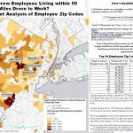
Do you drive to Drew? GIS Support Specialist, Krista White, did a speculative analysis of the carbon output of Drew employees who commute by automobile. The analysis uses zip code information to calculate the amount of carbon dioxide that would be produced by employees if they all drove to work each day. The analysis is restricted to a 50 mile radius of Drew, but provides much food for thought. If you drive to get to work on campus, the map and accompanying data may cause you to think more about alternative transportation.
Using GIS to Encourage Healthy Habits


Mapping Black Methodism


GIS for Campus Health and Safety


GIS and Civic Engagement
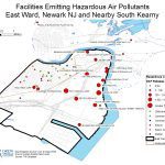
The Spatial Data Center at Drew is involved with a number of community partners in civic engagement projects to help them utilize GIS technology to support their missions. We are currently partnered with the Ironbound Community Corporation, helping them to map hazardous air pollutants and other toxins in the Ironbound community of Newark, NJ (for more information, see the GIS Summer Intern project below). We are helping the Communities of Shalom use GIS to create interactive, online maps of their Shalom Zones that promote peace and local community development in the U.S., Africa, and Haiti. The Spatial Data Center is also discussing a partnership with Haitian Artisans for Peace International to help them create online interactive maps and provide spatial data to map resources in the town of Mizak, Haiti.
Summer GIS Intern Helps Fight Medical Waste Incinerator in Newark


Analyzing History Using GIS
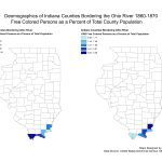
Dr. Wyatt Evans, Associate Professor of History, is investigating the use of GIS to explore population statistics in the Ohio River Valley between 1860 and 1870. The Spatial Data Center supplied Dr. Evans with the map product you see at the right, comparing the population of African-Americans in Indiana counties of the Ohio River Valley.
GIS Data Resources
  |
Data Resources: International DataIntegrated Public Use Microdata Series InternationalCensus data from 44 countries and 130 different census projects. Be aware that any data sets from this site will be using standard map projections and coordinate systems different from those used in the United States. As a result, adjustments may need to be made in your map files to accommodate these differences. NASA Global Change Master DirectoryMore than 25,000 descriptions of Earth science data sets and services for relevant to global change and Earth science research. Data Resources: U.S. DataGeodata.govProvides Tiger/Line shapefiles for the digital map base for a geographic information system or other mapping software. These files provide the outlines for U.S. state shapes and other basic digital, visual information and data onto which maps may be built. The files do not contain mapping software. Nationalatlas.govThe new National Atlas of the United States, providing a comprehensive, map-like view into the enormous wealth of geospatial and geostatistical data collected for the United States. It includes electronic maps and services that are delivered online. USGS National Map Seamless ServerProvides free data downloads, user-defined datasets, acquired data from different hosts, elevation point and profile tools and more for national and international geophysical data. U.S. DOT Federal Highway AdministrationLinks to datasets for roads, bridges, and highways across the U.S.. Also contains links to other types of data gathered by other federal agencies, including the Fish and Wildlife Service and the Army Corps of Engineers. U.S. Centers for Disease Control and PreventionLinks directly to the CDC’s resources for creating public health maps and for GIS and spatial analysis. |
Data Resources: New Jersey DataNew Jersey Department of Environmental Protection: Data DownloadsFreely available statewide data files and information for New Jersey. Note: Shape files are in a proprietary format usable in ArcGIS. New Jersey Department of Transportation GIS Data DownloadsShapefiles and geodatabase files available here for the New Jersey Roadway Network and the New Jersey Tide Telemetry System. Regional InformationEach region of New Jersey maintains specific data for their area. The following are links to GIS data for each region listed. Other ResourcesCenter for Spatially Integrated Social ScienceCSISS seeks to develop unrestricted access to tools and perspectives that will advance the spatial analytic capabilities of researchers throughout the social sciences. National Center for Geographic Information and AnalysisThe National Center for Geographic Information and Analysis is an independent research consortium dedicated to basic research and education in geographic information science and its related technologies, including geographic information systems (GIS). Look in the Education section of their web site to find resources for teaching interdisciplinary spatial analysis skills. Drew Sustainability Map |
Spatial Data Center Available Services


Course Material Development
Let the data center help incorporate spatial thinking, geographic information systems (GIS), or spatial statistics into your coursework, with course specific modules (in-class or online material)
Faculty Research
Let the data center help you to find spatial data, generate custom maps, and learn about geospatial techniques relevant to your work
Web Site Development
Let the data center produce digital maps and materials specific to your course needs
Equipment Loans
- Set of 15 Garmin eTrex and 2 Garmin Oregon receivers for classroom GPS exercises
- 5 laptops equipped with ESRI ArcGIS
- A professional survey grade Trimble GPS receiver, and 2 external antennae
Equipment loans are available to faculty and students for GIS work the field. To reserve equipment, please complete this form.
Training
- 1-on-1 or workshop training on GIS basics, GPS basics, and an introduction to spatial statistics
- Special topics in GIS (advanced statistics, open source software)
- Preparing professional posters for presentation
